Fietskaart The Ultimate UK Cycle Route Planner | Excellent Books
$16.95
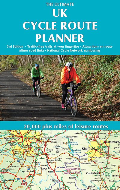
All of the UK’s signed cycle routes brought together on one map – now a comprehensively updated and expanded 3nd edition. Using the outstanding quality and detail of Times Comprehensive Atlas mapping, Sustrans’ National Cycle Network and other popular cycle trails are featured and defined – traffic free or on road. Family cyclists will love the listed traffic-free trails.
Other routes include regional routes such as county cycle ways and those National Trails on which bikes are allowed such as the Pennine Bridleway and the Ridgeway. Many hundreds of miles of minor road routes have been added for the 2nd edition and links to signed cross-channel routes such as the Avenue Verte (London-Paris) are shown so that long distance route planning is also made easy.
Are you looking for a new cycling routes in your local area or keen to plan a cycling tour this summer? If so, The Ultimate UK Cycle Route Planner could be the place to start.
The map, which includes an amazing 20,000-plus miles of routes, has been republished as a third edition by Excellent Books and now includes:
National Cycle network (NCN) route numbering.
A new route line and place name design to give a crisper, cleaner look that is easier to use than the previous edition.
Places of interest next to cycle routes, for example, National Trust properties, castles, museums etc.
All the classic cycle routes, such as the Caledonian Canal in the Highlands, Cornwall’s Camel Trail, Tweed Cycleway and the Scottish C2C.
Rail lines and stations and ferry connections so you can plan a cycling adventure that combines cycling with public transport.


